Gettyimages.com/ artas
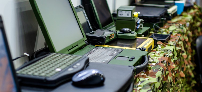
Army wants tougher, more mobile workstations for geospatial-intel
The Geospatial-Intelligence Workstation-Tactical program's goals include bringing capabilities to the tactical edge and helping battlefield commanders make better, quicker decisions.

The Army wants smaller and more mobile workstations for its geospatial intelligence work, according to a new request for information.
“As the modern battlefield evolves, the need for rapid, data-driven decision-making at the tactical edge has never been more critical,” the Army wrote in the RFI posted Wednesday.
The RFI and the resulting contract are part of the modernization goals outlined in the Army 2030 Strategy that emphasizes data dominance, maneuverability, and mission command.
The Army is calling the program Geospatial-Intelligence Workstation-Tactical, or GWS-T.
GWS-T will bring a more mobile version of the workstation to support brigade combat teams and maneuver brigades with real-time terrain analysis, route planning and intelligence preparation.
By having the workstations in tactical environments, the Army wants to reduce its reliance on higher-echelon processing centers and get faster, more precise decision making.
Requirements for the workstation include ruggedized components, working in a wide range of temperatures (20 to 120 degrees Fahrenheit), operating in varying humidity levels, and exposure to dust and sand.
The workstations cannot weigh more than 15 pounds and the edge node can weigh no more than 25 pounds, including its battery.
The units should include hot-swappable batteries or a second battery bay so it can operate continuously for 8-to-12 hours.
Responses are due May 30 and should not be more than five pages long.